2025 Fishing Atlas
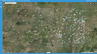
Click the link above for a searchable web map showing the 2025 Public Fishing Access locations. Click on individual tracts and points to display location information. Zoom to areas by city or county name with the search box and choose from various base map options.
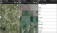
Use the free ArcGIS App to add public fishing locations to your mobile device (data signal required). Once the app is installed on your device, search the Maps for "KDWP FISH" and select the "KDWP: 2024 Fishing Access" map.
Files and instructions for various location format options. Includes Garmin GPS, Google Earth/GE Mobile, and Point/Lat-Long .txt and .csv files.
The maps in this atlas pinpoint a variety of public fishing areas, as well as public lands across Kansas. Walk-In Fishing Access (WIFA) areas are privately-owned ponds or streams the Kansas Department of Wildlife Parks (KDWP) has leased and opened to public fishing. WIFA sites are labeled by an abbreviated access period, size, and boating restriction for each location. Each map also shows all federal reservoirs, state fishing lakes, river access areas, and community lakes.
Please use the locator map above to select the part of Kansas that you want to fish. To download a specific map page, click on the specific number on the map above. A download box will appear, asking if you want to open or save the PDF with the map details. Make your selection and print the maps. Maps are all the same scale and can be taped together to create a large area map.
For information on reading the maps and other information in the Fishing Atlas click on the General Fishing Information PDF above or print out the whole atlas by clicking on Fishing Atlas .


